
 Menu
Menu Close
CloseWelcome!
These pages from RNLI Wells' Water Safety Officer offer advice and tips to stay safe and make the most of your visit to our part of the coast, whether you are on on the beach, walking the coast path or out on the water swimming, kayinging or sailing. There's videos, podcasts and some useful posters and documents.
We now have separate pages for Wells, Blakeney and Morston and Burnham Overy Staithe... though lots of the advice applies in all the North Norfolk harbours and beaches and along the coast in Norfolk or elsewhere too.
Wells Water Safety Map
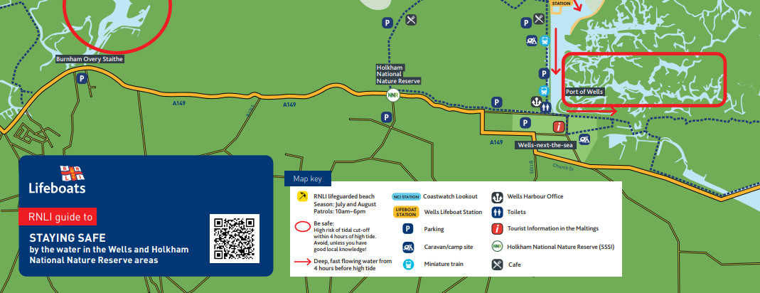 Our updated safety leaflet provides advice and a map for staying safe around the sea on Wells and Holkham beaches and the saltmarshes. You
can download and view or print a PDF version here...
Our updated safety leaflet provides advice and a map for staying safe around the sea on Wells and Holkham beaches and the saltmarshes. You
can download and view or print a PDF version here...
Download the map - updated 27/5/2022
Float To Live demonstration 12/8/25
Knowing how to calm your breathing, lie back and float could save your life.... our water safety officer demonstrates the RNLI's simple advice if you end up in the water unexpectedly...
- 1. Tilt your head back, submerging your ears
- 2. Relax and control your breathing
- 3. Move your arms and legs if you need to
- 4. It doesn't matter if your arms and legs hang down a bit; everyone floats differently
Try it yourself next time you're at a swimming pool or in the sea on the beach... it could save your life!
Sea currents demonstration 7/4/2026
We put a strong swimmer in the Wells harbour channel three hours before high water on an incoming tide just to show how strong the current really can be. See how quickly the water is moving and carroes him towards one of the swimming area buoys... and how even a strong swimmer can't swim very far against the current or even across it.
Learning about tides 28/5/2026
The tide comes in and goes out twice a day around the UK coast, with high water about 50 minutes later each day and larger and smaller tides (springs and neaps) over a two week cycle... our water safety volunteer and crew member Mandy looks at the ins and outs and the how and why...
Tides video in four shorter parts: Part 1 Part 2 Part 3 Part 4
Word Search - Cut off by the tide
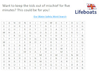
View Word Search (PDF)
BBC Radio interview January 2024
Download the podcast (mp3 file) to play later.
Getting started with swimming 9/7/25
Download the podcast (mp3 file) to play later
Swimming and lifesaving 6/3/2026
Download the podcast (mp3 file) to play later
Marine Police Podcast
Download the podcast (mp3 file) to play later
Don't get cut off by the tide
Advice to avoid being cut off by the tide on beaches and the marsh
One hour either side
Advice for swimmings, rowers and paddlers to avoid the strongest flows on the tide
Water Safety Local Ambassador Scheme - Wells
Liam Fayle-Parr speaks to water safety volunteer Mandy at Wells and the local water safety ambassadors at a local holiday park and tourist centre
A rescue performed by Blakeney Sailing Club
Tide Times
To avoid being cut off by the incoming tide on the sands or marshes, make sure you are back on the main Wells beach, coast path or the land-ward side of any channels or drains four hours before the time of high water shown above.
This website is run and managed by local volunteers at Wells-next-the-Sea lifeboat station and is not owned or operated by the RNLI
The Royal National Lifeboat Institution (RNLI) is a charity, registered in England and Wales (209603) and Scotland (SC037736).
All text and images copyright (C)2000-2026 RNLI Wells Lifeboat Station or as otherwise indicated, and may not be downloaded, copied or reproduced elsewhere
without prior permission of the station or the relevant copyright holder.